Friday was a special day! It was my first time in my many years of living in SoCal, venturing east past the town of Julian, and down the other side of the mountain to Anza Borrego Desert State Park. I have been wanting to go there for quite some time, and I made a commitment to get out there during this holiday break!
The turnoff on Highway 78 to the Slot Canyon trail is approximately a 90 minute drive from where I live. The trip takes you up through the town of Ramona, out past Santa Ysabel, then the popular mountain town of Julian, and finally down into Anza Borrego.
What an interesting name, eh! Anza, was a Spanish explorer, Juan Bautista de Anza to be precise. The Spanish word borrego means sheep, which was picked to represent the bighorn sheep that can be seen in this area. You can read a whole lot more about the park, and find camping info etc at this parks.ca.gov page.
Our day started early; we hit the road around 9am, and didn’t run into any issues with traffic or anything like that. I took my two kids along for the ride, having convinced them both to make the trip by showing them photos of the slot canyons.
If you are looking for the location of the parking lot, put these coordinates into your GPS/map, and they will land you right at the intersection where you need to turn: 33°09’32.7″N 116°13’09.6″W. It’ll be on your left hand side if you’re travelling east. From highway 78 to the parking lot (#1 on my map) is just shy of 2 miles down a bumpy sandy road. There are restroom facilities there, and a place to pay a $10 fee to park. Bring cash!
As soon as you park, you can immediately head down into the nearby slots which will be to your right as you drive in. We opted to take the trail to the left (#2), which gives you views of the slots from up above, and then winds around to a steep downhill section that some people were coming up from. This is a shorter loop that lots of people were taking, however we were in it for a much longer approx 4.5 – 5 mile trek. Or so we thought!
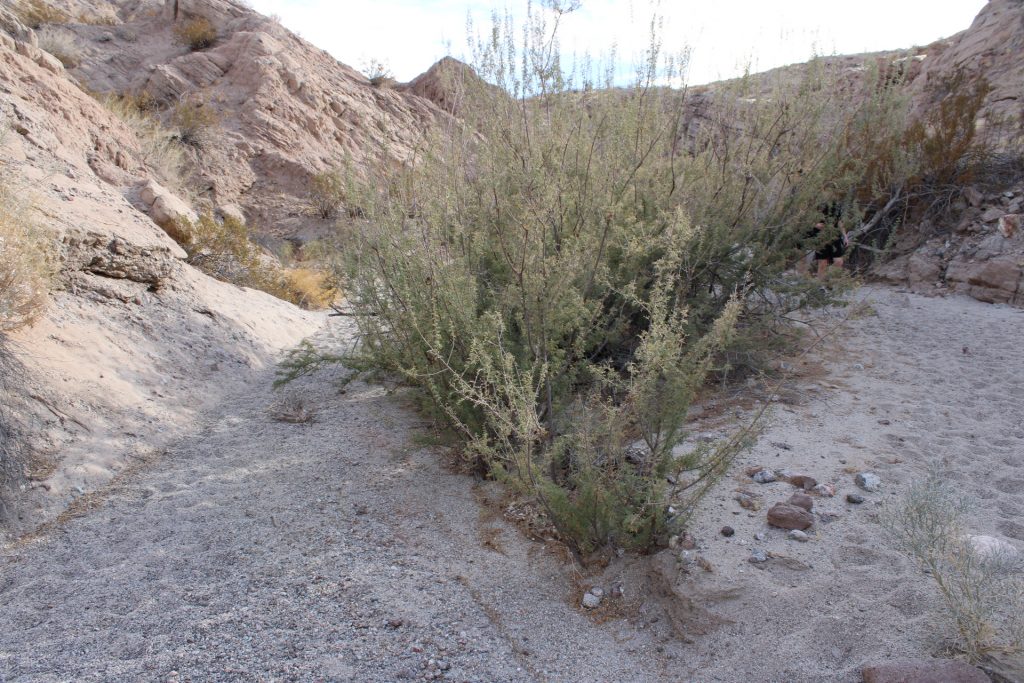
When we got to the bottom of the steep hill, we took a turn to our left (#3 on map). The next section was long! It’s basically a deep-sand trail, possibly a riverbed with no water this time of year, and it made for a more strenuous, but good, hike. It definitely has left me with some tight leg muscles for the last couple of days.
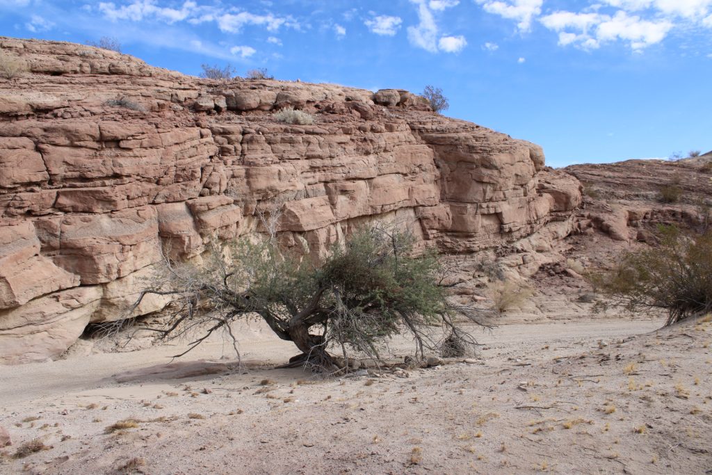
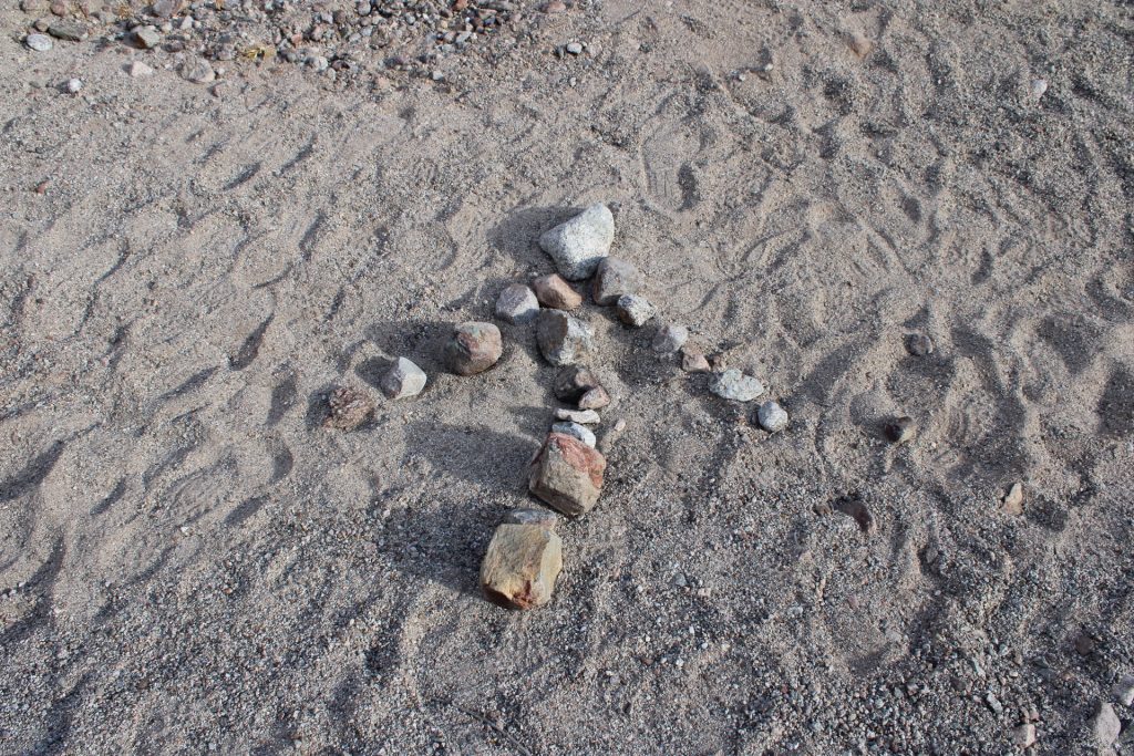
Marker #4 on my map shows where we took a wrong turn. I use the word ‘turn’ loosely, as we basically just followed what seemed to be the correct trail. The way we were supposed to go is not that easily noticeable. The best description I can give you is that there is a bush almost in the middle of the trail at this point, and the left turn is immediately after it, and up a hillside where you need to scramble with hands and feet. It wasn’t too strenuous, but definitely different than the sandy trail we had just come off. The turn is (as of Friday Jan 3 2025) marked with a rock arrow, but we totally missed that the first time around.
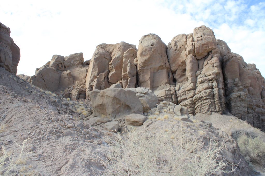
I have to say that as much as I was a little nervous once we realized we went the wrong way (kids with xme, depleting cell phone battery, middle of nowhere – you get it!), this section between #4 and #5 was probably the most visually impressive. The slots were amazing through this section, tight in places, and the kids loved the climbing and caves we passed. The point at which we doubled back was a 10-12 foot tall wall that I might have climbed if I had been alone, as I could see on the map that the trails connected, but I didn’t want to take the risk of anyone falling and getting hurt out there. So we turned back. If you have plenty of time, this is certainly a worthwhile detour.
It wasn’t that long of a hike back to the rock arrow, and as soon as we were back on the main trail, I was relieved.
This next section was mostly uphill for quite a while (until approx where ‘Borrego’ is shown on the map), with stunning views and amazing colors as the light was changing. I figured if we were going to see any wildlife, this might be the best opportunity, but besides a single bird and some desert ants, I don’t think we saw a single animal all day (we hiked for almost 4 hours, with a couple of breaks in between). My guess is that due to the amazingly beautiful weather we have had for many months, and the complete lack of rain, animals have to venture elsewhere for water.
The last section of the trail back to the parking lot was downhill along a ridgeline with more incredible views all the way. I can honestly say, this was one of the most impressive hikes I have ever been on. So rewarding in so many ways!
If I can leave you with one piece of advice, it is to download a map of these trails before you go. I had read this advice on All Trails, and took it, and I was thankful I did. I signed up for the 7 day free trial to allow me to have the map when cell service was unavailable (much of the time out here). Along with following the usual hiking advice, make sure your phone is fully charged, bring plenty of water etc, and don’t mess around with daylight hours! You do not want to be stuck out here in the dark!
Get out there, and enjoy! Let me know how it goes.
Photos and videos taken with Canon EOS Rebel T7 and GoPro Hero 13